Use these pages when your search is about a specific map, path, surge, or evacuation-zone question.
Learn why hurricane paths, intensity forecasts, cones, and arrival times change as observations and forecast guidance update.
Compare Atlantic, Eastern Pacific, and Central Pacific hurricane basins, storm-name lists, forecast centers, and active-system tracking.
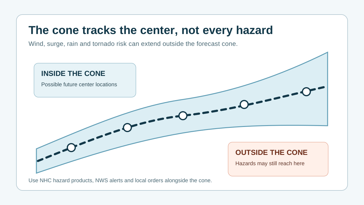
Understand the latest hurricane landfall forecast using the NHC track, cone, arrival timing, wind field, surge products, and local official alerts.
Compare a tropical storm vs hurricane by wind speed, forecast labels, warnings, surge, rainfall, tornado, and preparation decisions.
Compare hurricane categories 1 through 5, wind speed thresholds, likely wind damage, and why category does not measure surge or rainfall risk.
Track hurricanes approaching the Southeast and East Coast with live NHC paths, radar, alerts, and Georgia, Carolinas, Virginia, and Florida trackers.
Check whether a hurricane or tropical storm is in the Gulf right now with the live NHC map, current path, radar, and Gulf Coast alerts.
Learn how scientists and the National Hurricane Center track hurricanes with satellites, aircraft, radar, buoys, models, and official forecast advisories.
Understand what a hurricane warning means, how it differs from a watch, and how to turn NWS alerts into a household action plan.
See what hurricanes look like on satellite and radar: the eye, eyewall, rain bands, cloud structure, and why appearance alone is not a risk measure.
Learn how NHC tracks, forecast cones, radar, satellite, and local alert layers answer different storm questions, then open the current live map.
Track a hurricane path with live NHC storm context, current storm position, forecast cone explainers, city trackers, radar, and impact-window tools.
Learn how hurricane evacuation zones fit with local orders, storm surge risk, city trackers, alerts, and household evacuation planning tools.
Understand storm surge map context, NWS surge watches and warnings, ZIP checks, city trackers, and local evacuation planning.
Learn how hurricane spaghetti models, GFS, ECMWF, ICON, AI guidance, and model spread fit with the official NHC forecast and local alerts.
Plan hurricane-season cruises and flights with official storm updates, carrier terms, port status, flexible itinerary checks, and practical disruption steps.
Use hurricane radar and satellite with NHC storm context, rain bands, wind timing, local NWS alerts, and city tracker links.
Learn how to use a live hurricane tracker with NHC advisories, radar, alerts, city pages, and local decision tools, then open the current storm map.
Build a hurricane preparedness checklist for supplies, documents, pets, medical needs, power outages, family communication, and evacuation timing.
Build a hurricane evacuation plan with local zones, departure triggers, destinations, routes, transport, pets, medical needs, and official alerts.
Learn hurricane mitigation strategies for wind, water, buildings, utilities, land use, insurance, and community resilience before the next storm.
Run a hurricane drill for families, workplaces, schools, or community groups using realistic alerts, evacuation, communication, shelter, and recovery tasks.
Follow an after-hurricane cleanup and recovery checklist for reentry, downed lines, floodwater, generators, mold, food, water, insurance, and repairs.