Radar + Satellite Toggle
Switch between precipitation radar and NOAA GOES-East satellite. Choose GeoColor, infrared, or water vapor; the loop control opens the current official animation without adding a heavy map download.
Live radar and satellite
Compare live hurricane radar with NOAA GOES-East GeoColor, infrared, water-vapor, and official satellite-loop views for the Atlantic, Gulf, East Coast, and Caribbean. Use cloud structure for observation, then check NHC and NWS sources for forecasts and local decisions.
Natural-color GOES-East imagery over the Atlantic and Americas. Pan and zoom to inspect cloud systems in true color.

High-resolution full disk preview from NOAA GOES-East. Use the interactive map layer for zoomed analysis.
Switch between precipitation radar and NOAA GOES-East satellite. Choose GeoColor, infrared, or water vapor; the loop control opens the current official animation without adding a heavy map download.
When NHC provides current storm coordinates, the map drops storm markers and links to official NHC advisory pages.
The sidebar loads NWS active alerts for a selected state, draws their areas on the map, and turns them into a Monitor, Prepare, Act, or Leave decision snapshot.
Use the radar layer to inspect recent precipitation bands and squall-line structure. Radar coverage is strongest where ground radar networks are available.
Switch to satellite mode for zoomable GOES-East GeoColor, infrared, and water-vapor layers. Open the official NOAA loop to watch cloud structure change, then use NHC advisories for the forecast.
Confirm any action with NHC advisories, NWS alerts, and local emergency management. This map is context, not an evacuation order.
Radar search guide
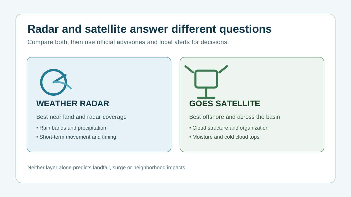
Hurricane radar and hurricane satellite answer different questions. Satellite is better for storms over open water because it shows cloud organization, convective bursts, and whether the circulation is becoming better defined. Radar becomes more useful near land because it can show rain-band timing, embedded thunderstorms, and short-term changes closer to a specific city.
If you are using a live hurricane radar map during a developing threat, do not stop at the map. Use radar for near-term precipitation context, satellite for storm structure, the live hurricane tracker for NHC storm position, and NWS alerts for official watch and warning language.
From map to action
If bands are offshore and no local warning is active, save your area, refresh the map periodically, and read the cone of uncertainty guide before assuming the centerline is the only risk.
If rain bands are approaching or watches are active, use the preparedness checklist, review outage needs, and check whether household members need earlier transportation or medical planning.
If warnings, surge alerts, evacuation orders, or dangerous flooding are in effect, follow local emergency management instructions and use the evacuation decision helper only as a planning aid.
It shows RainViewer precipitation radar, interactive GOES-East GeoColor, infrared, and water-vapor satellite layers, official NOAA GOES hurricane loops, a high-resolution full-disk preview, forecast radar, wind, NHC storm markers, and state-level NWS alerts for decision context.
Radar frames and alerts can change quickly. Use the refresh button, then verify important decisions with official NHC advisories, weather.gov alerts, and local emergency management.
Use satellite first when a tropical system is far offshore or organizing over open water, then use radar when rain bands move within range of coastal radar sites. For household decisions, pair both layers with NWS alerts and local evacuation guidance.
Switch the map to Satellite, choose GeoColor, infrared, or water vapor, then use the play control to open the current official NOAA GOES loop. The loop shows changing cloud structure, not a forecast or impact boundary.
No. Satellite loops show observed cloud and moisture patterns. Use the official NHC forecast, local NWS alerts, and emergency management guidance for forecast and protective decisions.
Check whether your state or county has active NWS alerts, review your nearest city tracker, then move from monitoring to preparation or evacuation planning if official warnings, surge risk, or local orders apply.
Check your official local warning first, compare it with the current NHC storm position, then decide whether your home, route, or medical needs require earlier action than the county deadline.
NHC advisories usually update on a cycle set by the storm situation, while NWS alerts can change at any time. HurricaneHub caches public feeds for short windows to reduce latency without hiding official updates.
No. HurricaneHub summarizes official data for decision support, but evacuation orders, shelter rules, road closures, and rescue instructions come from local emergency management and the National Weather Service.