Step 1
Start With Current Storms
Use the live hurricane tracker to see whether the NHC has an active system, where the center is, and which advisory links matter.
Hurricane map guide
Use this guide to choose the right hurricane map layer. The live tracker is the canonical page for current storm position and NHC status; this page explains when to use radar, satellite, the forecast track, and local alerts.
how to read a hurricane map, hurricane map layers, forecast cone map
Step 1
Use the live hurricane tracker to see whether the NHC has an active system, where the center is, and which advisory links matter.
Step 2
Switch to radar and satellite when you need rain bands, cloud structure, and local weather timing instead of only the forecast track.
Step 3
Open city trackers and alerts to connect the storm map with surge exposure, flooding, evacuation routes, bridges, and outages.
What the map answers
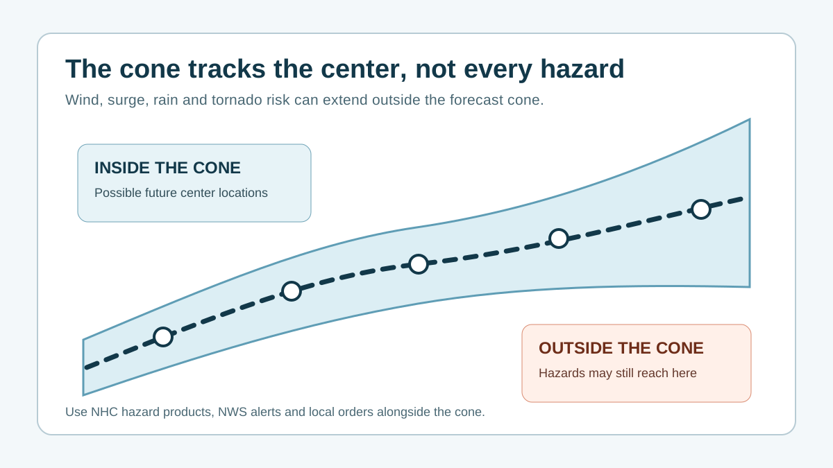
A tracker map helps explain where the storm is and how the forecast is evolving. Local impacts can still happen outside the centerline, so the next step is always local alert and location context.
Common mistake
Wind, surge, rainfall flooding, tornadoes, and outages can occur away from the plotted center. Use the map as the start of the workflow, then check watches, warnings, and local instructions.
Related hurricane resources
Active storm hub with NHC checks, radar shortcuts, alerts, and city pages.
Move from the map into ZIP, city, state, surge, and evacuation-zone context.
Radar, satellite, wind, and alert layers for local weather context.
Local pages for surge, flooding, route, outage, and evacuation context.
Estimate distance from a storm to a location while keeping local hazards in context.
Official-source check
HurricaneHub is a planning and interpretation layer. During an active threat, confirm storm advisories, watches, warnings, evacuation orders, shelters, and road restrictions with official sources.
Local planning
After reading this hub, the most useful next page is usually a city tracker, state tracker, alert page, or household tool that matches the place you care about.
Start with the live hurricane tracker map for official storm context, then compare radar, satellite, NWS alerts, local risk, and city pages before making household decisions.
A tracker map may link to local resources, but evacuation orders come from local emergency management. Always verify orders, shelters, and routes with official local sources.
Hurricane impacts can spread far from the center. Storm surge, rainfall flooding, tornadoes, and power outages need separate local alert checks.
Check your official local warning first, compare it with the current NHC storm position, then decide whether your home, route, or medical needs require earlier action than the county deadline.
NHC advisories usually update on a cycle set by the storm situation, while NWS alerts can change at any time. HurricaneHub caches public feeds for short windows to reduce latency without hiding official updates.
No. HurricaneHub summarizes official data for decision support, but evacuation orders, shelter rules, road closures, and rescue instructions come from local emergency management and the National Weather Service.