Learn how El Niño can change Atlantic and Pacific hurricane patterns, why it does not control one storm, and how to use official forecasts safely.
Published 2026-09-09 · Last modified 2026-09-17
Key Takeaways
El Niño Is a Climate Pattern, Not a Hurricane
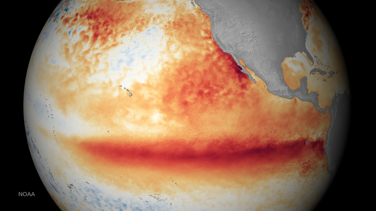
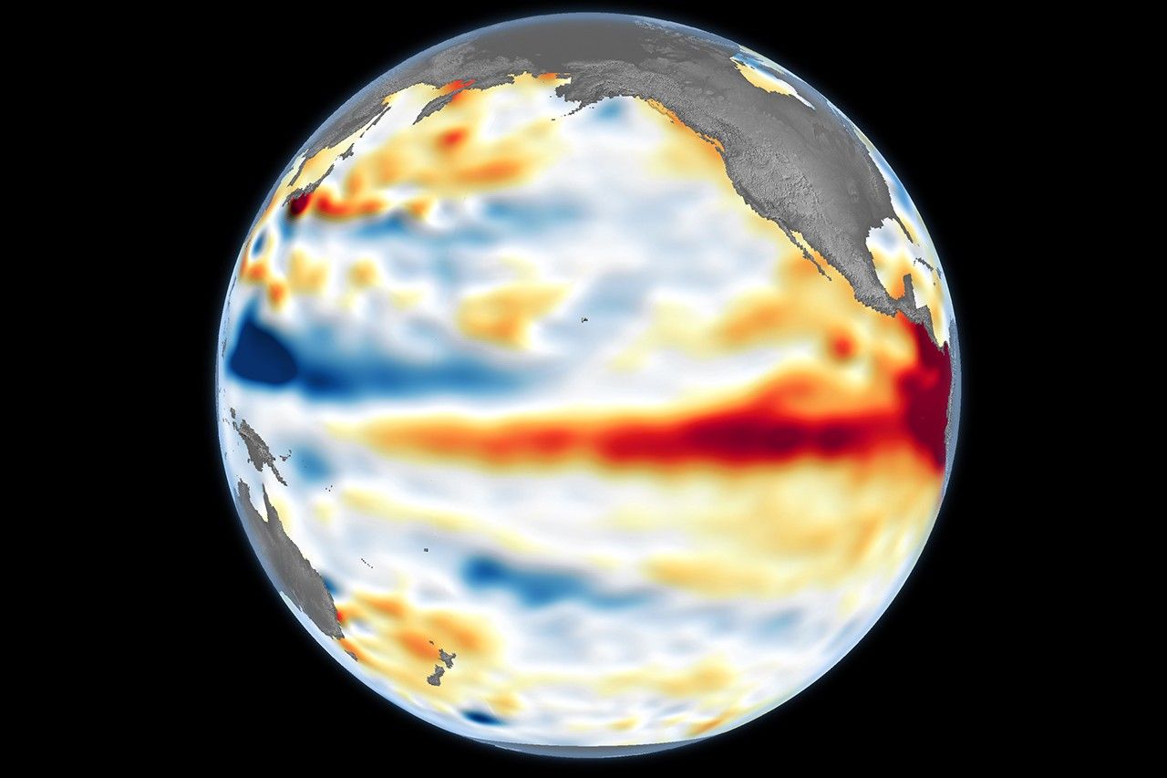
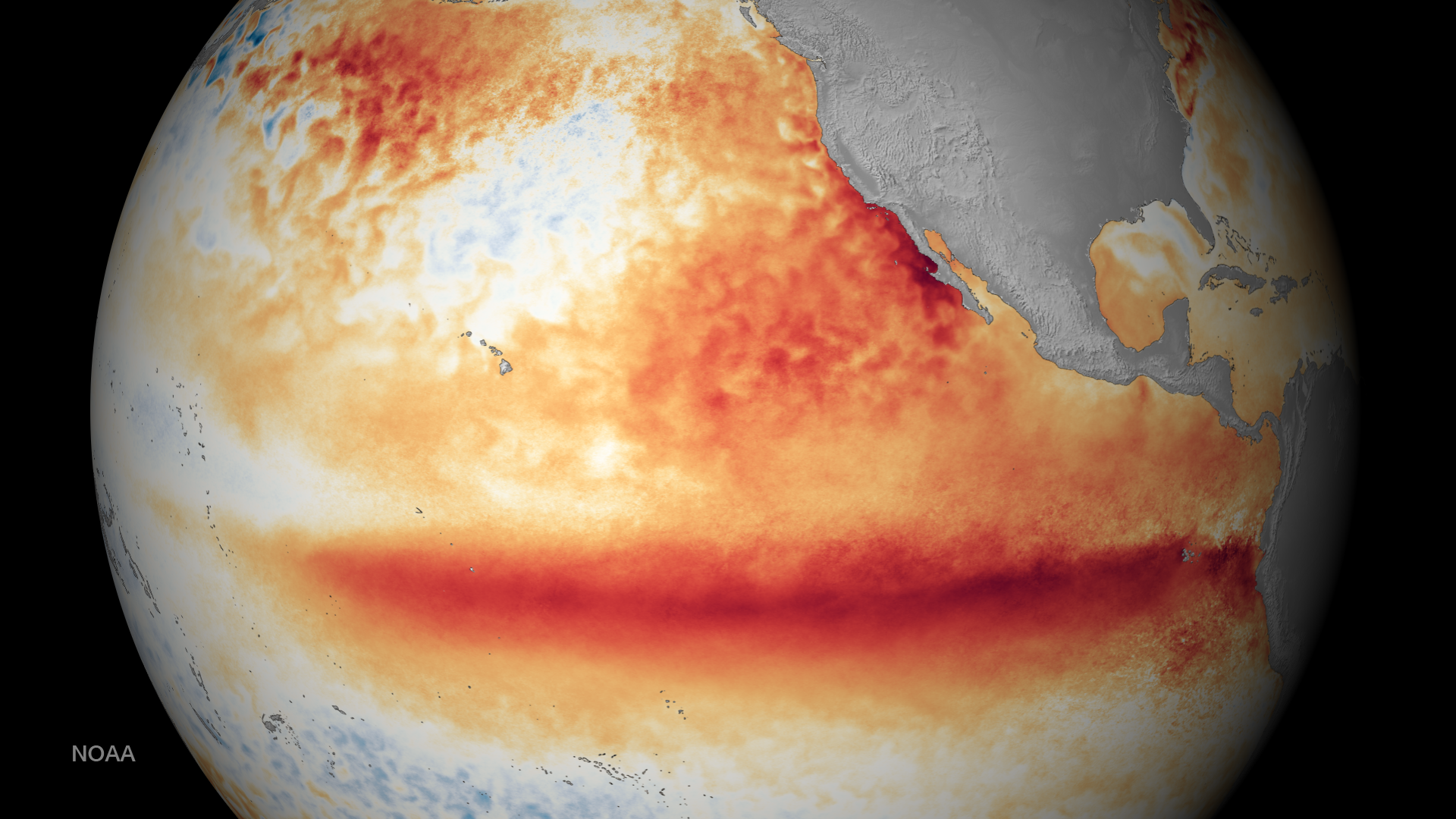
El Niño describes unusually warm sea-surface temperatures across part of the equatorial Pacific and the atmosphere's response to them. A hurricane such as Lowell is a specific tropical cyclone with a tracked center, measured winds, pressure, advisories, and a forecast. The two can be discussed together as background and event, but they are not the same thing, and El Niño alone does not explain why one storm formed.
Why Atlantic Activity Often Changes
During many El Niño episodes, the altered circulation increases upper-level westerly winds over the tropical Atlantic. That can increase vertical wind shear, the change in wind speed or direction with height. Shear may tilt a developing circulation, separate thunderstorms from the center, or limit intensification. This is a basin-wide tendency, not a guarantee: sea-surface temperature, moisture, dry air, African easterly waves, and each storm's track also matter.
Seasonal outlooks describe probabilities across a basin, not a city-specific landfall.
A below-normal season can still produce a dangerous hurricane.
A single storm can develop despite an otherwise unfavorable climate pattern.
The Pacific Response Can Differ
El Niño often supports a more favorable large-scale environment for eastern and central Pacific tropical cyclones than for Atlantic systems, but the result varies by location, month, and other weather patterns. That is why a Pacific storm and an Atlantic outlook should be read separately. Do not transfer an Atlantic seasonal statement directly to a Pacific storm such as Lowell.
How to Use This Information Safely
Use El Niño information to understand seasonal context, then check HurricaneHub's 2026 hurricane season tracker for observed Atlantic activity. Once a system is active, switch to the live hurricane tracker, current NHC advisory, forecast track, watches or warnings, and local NWS and emergency-management guidance. No climate pattern or map should replace a local evacuation order.
What El Niño Cannot Tell You
El Niño cannot identify which city will be hit, determine a storm's exact intensity, or prove that a particular hurricane was caused by the pattern. Those questions require current observations and official forecasts. Treat climate signals as one input to planning, not as a reason to ignore an active storm or delay preparation.
NOAA/NESDIS satellite imagery shows the ocean temperature background associated with an El Niño episode. Public domain.NASA Earth Observatory visualization of El Niño ocean conditions. Public domain; image courtesy of NASA/JPL-Caltech.NOAA/NESDIS satellite view of a strong El Niño pattern. Public domain; image courtesy of NOAA.
Official Source Check
Before making a life-safety decision, check weather.gov, your local emergency management agency, and current NHC advisories. NOAA/NESDIS and NASA images in this article are public-domain source visuals.
Next Actions After Reading
Use the article for background, then move to the tracker, alert, city, or planning page that matches your current situation.
Move from general guidance to local storm surge, flooding, route, outage, and alert context.
Hurricane FAQ
Is Hurricane Lowell the same thing as El Niño?
No. Lowell is a specific eastern Pacific tropical cyclone. El Niño is a large-scale equatorial Pacific climate pattern that can influence the background environment for many weather systems.
Does El Niño stop Atlantic hurricanes?
No. El Niño often increases Atlantic vertical wind shear and lowers the statistical odds of basin-wide activity, but it cannot prevent every hurricane or determine the risk for one coastline.
Can El Niño predict a hurricane landfall?
No. Seasonal climate patterns provide broad probabilities. Landfall risk comes from the storm's current observations, official NHC forecast, watches or warnings, and local guidance.
Why can the Pacific and Atlantic respond differently?
The two basins have different background winds, ocean temperatures, and storm-development regions. A climate pattern that suppresses some Atlantic development can support more favorable Pacific conditions in some periods.
What should I check during an active storm?
Check the latest NHC advisory and forecast products, local NWS alerts, and emergency-management instructions. Use HurricaneHub's live tracker as an access point to those current sources.